Hurricane Season sign

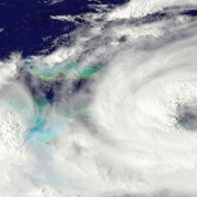
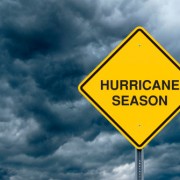
Hurricane Season Is Here

Florida’s hurricane season begins on June 1 and ends November 30. Based on historical weather records dating back to the 1950s, a typical season will average 12 tropical storms with sustained winds of at least 39 miles per hour, of which six may turn into hurricanes with winds of 74 miles per hour or more. In addition to high winds, hurricanes and tropical storms can bring torrential rainfall and localized flooding.

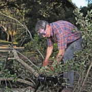
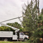
Localized flooding from these types of severe weather events can be exacerbated because of improperly maintained drainage systems. Residential communities and businesses can help mitigate the impacts from severe storms. One of the most important steps is the regular inspection and maintenance of drainage infrastructure. Drainage infrastructure can include inlets, discharge control structures, connecting pipes and ponds. Proper maintenance of these facilities will ensure unobstructed flow of stormwater and fully operational equipment.

Additionally, residential communities and businesses with operable discharge control structures can request authorization from the Lake Worth Drainage District (LWDD) to open these structures prior to the storm. Lowering pond levels prior to the rain event provides additional storage in ponds for excess stormwater. The LWDD recommends establishing a Drainage Committee whose role is to provide for the maintenance and operation of the community or business’s drainage system. Drainage Committees may consist of board members, residents and/or property managers. All members of the Drainage Committee should register with the LWDD on its website at www.lwdd.net/storm-response. This registration process ensures the LWDD knows who to contact and where to send important weather alerts and instructions.

During the storm, LWDD personnel will monitor canal elevations and make operational adjustments to major flood control structures as needed. Depending on the volume and duration of rainfall, expect streets, sidewalks, driveways and lawns to flood. These areas are designed to function as secondary detention areas and help to keep water away from homes and businesses. This flooding is temporary and will begin to recede after an event has passed. However, always follow emergency management instructions if told to evacuate.

It may be tempting to explore outside, for your safety and to keep roadways clear for emergency response vehicles, stay indoors until told otherwise by authorities. Do not try to walk in flooded areas. Flood water may be unsanitary and there may be downed power lines or other hazards that are not visible. Do not try to drive through flooded areas. Vehicles can become unstable and float in just inches of water. Additionally, canal banks may fail, and roadways may be impacted by sinkholes. The location of roads and sidewalks may not be discernible from canals due to the sheeting effect of flood water and life-threatening accidents can occur.

No system, no matter how well designed, is 100% flood proof but collaborating with communities, businesses and other water management agencies, LWDD can help keep you and your property safe from potential flooding.

Man with chain saw cutting up fallen tree branches

Post-Storm Debris Removal: What You Can Expect

Following a severe storm event, the Lake Worth Drainage District (LWDD) conducts immediate post-storm assessments, inspecting water control structures, canal channels and the canal rights-of-way for vegetative debris with the potential to negatively impact drainage.

The public can assist via our Citizen Damage Reporting System located on our website at https://www.lwdd.net/storm-response.  The user will be asked a few questions and a map will be provided to help identify the location of the incident. These public reports as well as LWDD staff assessments are reviewed and prioritized for vegetation removal. Priority is based on the following criteria:

  • High Priority – vegetation is in the water and threatening drainage
  • Medium Priority – vegetation is blocking the right-of-way and encumbering access or vegetation is significantly leaning over the waterway and could be a potential future threat to drainage
  • Low Priority – vegetation located on the LWDD right-of-way that may partially reduce access

Depending on the severity of the storm damage it may take several weeks before crews can address low priority incidents. Private property owners that wish to trim vegetation that has fallen or is leaning on their property from the LWDD right-of-way may do so at their discretion and expense. If access to the LWDD right-of-way is necessary to trim or remove vegetation, the property owner should receive prior approval from the LWDD for temporary access.

Any material from trimming or tree removal by the property owner must be properly disposed of by the resident or if applicable the contractor performing the work. Keep in mind that it is unlawful to place any debris in the canal or on the right-of-way in anticipation that LWDD will remove the material. Unlawful dumping will be reported to the authorities.

If fallen debris has damaged personal property, the individual property owner should contact their insurance company to submit a claim. The LWDD will not directly reimburse property owners for damage caused by acts of mother nature.

After a major storm event, debris clean-up is paramount to getting back to normal and the LWDD is committed to quick removal of hazardous flood prone debris for the safety of our residents.

Australian Pine removal

That’s A Good Question

What are LWDD’s contingency plans for canal maintenance projects that are underway during hurricane season?

The Lake Worth Drainage District is always mindful of the potential effects of severe storms on project sites. Staff regularly monitor weather conditions for potential impacts. Each storm is unique, and the required preparation will be determined depending on the specific weather prediction and status of the project site.

hurricane image

El Niño and La Niña Explained

El Niño and La Niña are climate phenomena that originate in the equatorial Pacific Ocean. These phenomena can have wide-ranging effects on weather around the world.

Never occurring simultaneously and sometimes not at all, El Niño and La Niña are the opposite phases of the El Niño-Southern Oscillation, or ENSO. ENSO describes the fluctuation of two elements, temperature and pressure.

The temperature component of ENSO refers to ocean water temperature. When sea-surface temperatures are above average by about 1 degree Fahrenheit or more, El Niño can develop. When temperatures are below average, La Niña can form. When temperatures are at or near average neither develops. This is called ENSO-neutral.

The air pressure component refers to the difference in air pressure between the western and eastern parts of the equatorial Pacific. Scientists use readings from Darwin, on the north-central coast of Australia, and from Tahiti, more than 5,000 miles to the east. When the pressure is lower than normal in Tahiti and higher than normal in Darwin, conditions favor the development of El Niño. When the opposite occurs, La Niña may develop.

The two components, temperature and pressure, are strongly related, and conditions of both must be right for either El Niño or La Niña to form. For example, if sea-surface temperatures favor El Niño but air pressure conditions do not, El Niño will not develop.

Scientists are not sure exactly what starts the process. But from time to time, air pressure conditions change over the equatorial Pacific, affecting the trade winds, which normally blow from east to west. The winds act on the surface of the water pushing it along. If the trade winds strengthen, as occurs during La Niña, more warm water is pushed westward. And in the eastern Pacific cold, deep water rises-up to replace it. If the trade winds weaken, as happens during El Niño, less water moves westward and less cold water rises, and the central and eastern Pacific warm up more than usual.

A huge mass of warm water in the ocean transfers a lot of heat high into the atmosphere through convection. Convection is when warm, moist air rises from the sea surface and forms storms. The heat in turn affects atmospheric circulation, both in the north-south direction and east-west.

The location of the convection is important. In El Niño, because the warm water stays in the eastern Pacific, the convection occurs there. In La Niña, the eastern Pacific stays colder, and the convection occurs much farther to the west.

The changes in atmospheric circulation can result in changes in weather in various parts of the world, what meteorologists call teleconnections. Much of this is related to the position of the jet stream, the high-altitude winds that sweep across the planet from west to east.

In El Niño, the jet stream tends to shift to the south. That can bring rain and cooler conditions to much of the Southern United States, and warmer conditions to parts of the North. Elsewhere, El Niño can create warm, dry conditions in Asia, Australia and the Indian subcontinent. Parts of Africa and South America can be affected as well.

In La Niña, the jet stream shifts northward. That can lead to warm and dry conditions in the Southern United States, and cooler, wetter weather in parts of the North, especially the Pacific Northwest. Parts of Australia and Asia can be wetter than normal.

In the U.S., the National Oceanic and Atmospheric Administration (NOAA) declares when an El Niño or La Niña event begins. Weather forecasters will talk about how a developing El Niño, for example, may bring a wetter, or perhaps a drier, winter. Or they may describe how an established La Niña is making for a more active hurricane season. It’s important to note that these are just typical effects. El Niño and La Niña sometimes don’t follow the expected patterns. Also, strength matters and a strong El Niño, as measured by how high sea-surface temperatures are above normal, will have greater effect.

How do El Niño and La Niña effect the Atlantic Hurricane season? The chances for the continental U.S. and the Caribbean Islands to experience a hurricane substantially increase during La Niña and decrease during El Niño.

El Niño produces stronger westerly winds at upper levels of the atmosphere across the tropical Atlantic. This increases the vertical wind shear, basically shearing the tops from developing storms before a healthy circulation can form. El Niño events generally suppress Atlantic hurricane activity so fewer hurricanes than normal form in the Atlantic during August to October, the peak of Atlantic hurricane season.

During La Niña, westerly winds high in the atmosphere weaken. This results in an expanded area of low vertical wind shear, allowing more Atlantic hurricanes to develop. La Niña not only increases the number of hurricanes that develop but may allow stronger hurricanes to form.

El Niño and La Niña also influence where Atlantic hurricanes develop. During La Niña, more hurricanes form in the deep Tropics from weather disturbances that originate over North Africa. These systems have a much greater likelihood of becoming major hurricanes, and of eventually reaching the U.S. and the Caribbean Islands.

 Although hurricanes occur more often during La Niña episodes, significant tropical weather events have occurred during the neutral phase. For example, the record shattering 2005 hurricane season that included Katrina and Rita occurred during the neutral phase. And in 1992, Hurricane Andrew, the most destructive United States hurricane of record, made landfall along the Gulf coast during a neutral phase of the El Niño-Southern Oscillation.

Broom cleaning up vegetation

LWDD – Post-Storm Clean-up

Following a severe storm event, the Lake Worth Drainage District (LWDD) conducts immediate post-storm assessments, inspecting water control structures, canal channels and the canal rights-of-way for vegetative and other debris with the potential to negatively impact drainage.

The public can assist by reporting storm damage via our Citizen’s Reporting System located on our website at https://lwddnet.wpengine.com/storm-response.  The user will be asked a few questions and a map will be provided to help identify the location of the incident in real-time. These public reports as well as LWDD staff assessments are reviewed and prioritized for vegetation removal. Priority is based on the following criteria:

  • High Priority – vegetation is in the water and threatening drainage
  • Medium Priority – vegetation is blocking the right-of-way and encumbering access or vegetation is significantly leaning over the waterway and could be a potential future threat to drainage
  • Low Priority – vegetation located on the LWDD right-of-way that may partially reduce access

Depending on the severity of the storm damage it may take several weeks before crews can address low priority incidents. Private property owners that wish to trim vegetation that has fallen or is leaning on their property from the LWDD right-of-way may do so at their discretion and expense. If access to the LWDD right-of-way is necessary to trim or remove vegetation, the property owner should receive prior approval from the LWDD for temporary access.

Any material from trimming or tree removal by the property owner must be properly disposed of by the resident or if applicable the contractor performing the work. Keep in mind that it is unlawful to place any debris in the canal or on the right-of-way in anticipation that LWDD will remove the material. Unlawful dumping will be reported to the authorities.

If fallen debris has damaged personal property, the individual property owner should contact their insurance company to submit a claim. The LWDD will not directly reimburse property owners for damage caused by acts of mother nature.

After a major storm event, debris clean-up is paramount to getting back to normal and the LWDD is committed to quick removal of hazardous flood prone debris for the safety of our residents.