El Niño and La Niña Explained
El Niño and La Niña are climate phenomena that originate in the equatorial Pacific Ocean. These phenomena can have wide-ranging effects on weather around the world.
Never occurring simultaneously and sometimes not at all, El Niño and La Niña are the opposite phases of the El Niño-Southern Oscillation, or ENSO. ENSO describes the fluctuation of two elements, temperature and pressure.
The temperature component of ENSO refers to ocean water temperature. When sea-surface temperatures are above average by about 1 degree Fahrenheit or more, El Niño can develop. When temperatures are below average, La Niña can form. When temperatures are at or near average neither develops. This is called ENSO-neutral.
The air pressure component refers to the difference in air pressure between the western and eastern parts of the equatorial Pacific. Scientists use readings from Darwin, on the north-central coast of Australia, and from Tahiti, more than 5,000 miles to the east. When the pressure is lower than normal in Tahiti and higher than normal in Darwin, conditions favor the development of El Niño. When the opposite occurs, La Niña may develop.
The two components, temperature and pressure, are strongly related, and conditions of both must be right for either El Niño or La Niña to form. For example, if sea-surface temperatures favor El Niño but air pressure conditions do not, El Niño will not develop.
Scientists are not sure exactly what starts the process. But from time to time, air pressure conditions change over the equatorial Pacific, affecting the trade winds, which normally blow from east to west. The winds act on the surface of the water pushing it along. If the trade winds strengthen, as occurs during La Niña, more warm water is pushed westward. And in the eastern Pacific cold, deep water rises-up to replace it. If the trade winds weaken, as happens during El Niño, less water moves westward and less cold water rises, and the central and eastern Pacific warm up more than usual.
A huge mass of warm water in the ocean transfers a lot of heat high into the atmosphere through convection. Convection is when warm, moist air rises from the sea surface and forms storms. The heat in turn affects atmospheric circulation, both in the north-south direction and east-west.
The location of the convection is important. In El Niño, because the warm water stays in the eastern Pacific, the convection occurs there. In La Niña, the eastern Pacific stays colder, and the convection occurs much farther to the west.
The changes in atmospheric circulation can result in changes in weather in various parts of the world, what meteorologists call teleconnections. Much of this is related to the position of the jet stream, the high-altitude winds that sweep across the planet from west to east.
In El Niño, the jet stream tends to shift to the south. That can bring rain and cooler conditions to much of the Southern United States, and warmer conditions to parts of the North. Elsewhere, El Niño can create warm, dry conditions in Asia, Australia and the Indian subcontinent. Parts of Africa and South America can be affected as well.
In La Niña, the jet stream shifts northward. That can lead to warm and dry conditions in the Southern United States, and cooler, wetter weather in parts of the North, especially the Pacific Northwest. Parts of Australia and Asia can be wetter than normal.
In the U.S., the National Oceanic and Atmospheric Administration (NOAA) declares when an El Niño or La Niña event begins. Weather forecasters will talk about how a developing El Niño, for example, may bring a wetter, or perhaps a drier, winter. Or they may describe how an established La Niña is making for a more active hurricane season. It’s important to note that these are just typical effects. El Niño and La Niña sometimes don’t follow the expected patterns. Also, strength matters and a strong El Niño, as measured by how high sea-surface temperatures are above normal, will have greater effect.
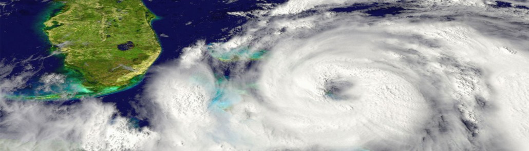
How do El Niño and La Niña effect the Atlantic Hurricane season? The chances for the continental U.S. and the Caribbean Islands to experience a hurricane substantially increase during La Niña and decrease during El Niño.
El Niño produces stronger westerly winds at upper levels of the atmosphere across the tropical Atlantic. This increases the vertical wind shear, basically shearing the tops from developing storms before a healthy circulation can form. El Niño events generally suppress Atlantic hurricane activity so fewer hurricanes than normal form in the Atlantic during August to October, the peak of Atlantic hurricane season.
During La Niña, westerly winds high in the atmosphere weaken. This results in an expanded area of low vertical wind shear, allowing more Atlantic hurricanes to develop. La Niña not only increases the number of hurricanes that develop but may allow stronger hurricanes to form.
El Niño and La Niña also influence where Atlantic hurricanes develop. During La Niña, more hurricanes form in the deep Tropics from weather disturbances that originate over North Africa. These systems have a much greater likelihood of becoming major hurricanes, and of eventually reaching the U.S. and the Caribbean Islands.
Although hurricanes occur more often during La Niña episodes, significant tropical weather events have occurred during the neutral phase. For example, the record shattering 2005 hurricane season that included Katrina and Rita occurred during the neutral phase. And in 1992, Hurricane Andrew, the most destructive United States hurricane of record, made landfall along the Gulf coast during a neutral phase of the El Niño-Southern Oscillation.


