Photo of Tommy Strowd, PE

Hurricane Dorian Update for LWDD Residents

3-day rain image

Before, During And After The Storm

Florida’s hurricane season begins on June 1 and ends November 30. Based on historical weather records dating back to the 1950s, a typical season will average 12 tropical storms with sustained winds of at least 39 miles per hour, of which six may turn into hurricanes with winds of 74 miles per hour or more. In addition to high winds, hurricanes and tropical storms can bring torrential rainfall. These severe weather events can produce localized flooding that can be exacerbated by improperly maintained drainage systems.

Residential communities and businesses can help mitigate the impacts of severe storms with a few simple steps. One of the most important steps is the regular inspection and maintenance of drainage infrastructure. Drainage infrastructure can include inlets, discharge control structures, connecting pipes, and lakes. Proper maintenance of these facilities will ensure the unobstructed flow of stormwater and fully operational equipment. Secondly, residential communities and businesses with operable discharge control structures can request authorization from the Lake Worth Drainage District to open these structures prior to the storm. Lowering lake levels provides additional storage for excess stormwater. The Lake Worth Drainage District recommends the establishment of a Drainage Committee whose role is to provide for the maintenance and operation of the community or business’ drainage system. Drainage Committees may consist of board members, residents and/or property managers. All members of the Drainage Committee should register with the Lake Worth Drainage District on its website at www.lwdd.net. This registration process ensures the Lake Worth Drainage District knows who to contact and where to send important weather alerts and instructions.

During the storm event, follow emergency management instructions via the television or radio and take appropriate actions to keep yourself, family and property safe. In most circumstances, emergency personnel will not be deployed during the weather event. Depending on the volume and duration of rainfall, expect streets, sidewalks, driveways, and lawns to flood. These areas are designed to act as secondary detention areas and help to keep water away from homes and businesses. This flooding is temporary and will begin to recede after an event has passed. District personnel will be monitoring canal elevations and making operational adjustments to major flood control structures. This work can be conducted during the storm via wireless mobile devices and provide instantaneous response to changes in water elevations.

It may be tempting to explore outside but stay indoors after the storm. For your safety and to keep roadways clear for emergency response vehicles, stay inside until told otherwise by authorities. Do not attempt to walk in flooded areas. Flood water may be unsanitary and there may be downed power lines or other hazards that are not visible. Do not attempt to drive through flooded areas. Vehicles can become unstable and float in as little as a few inches of water. Additionally, canal banks may fail, and roadways may be affected by sinkholes. The location of roads and sidewalks may not be discernible from canals and lakes and life-threatening accidents can occur.

While weather predictions are becoming more sophisticated, forecasters are still unable to predict exactly where a storm will make landfall. The likelihood of flooding depends on several variables such as rainfall volume, ground moisture, and local terrain. No system, no matter how well designed, is 100% flood proof but working closely with communities, businesses and other water management agencies, LWDD can help keep you and your property safe from potential flooding.

trees with wind

Hurricane Michael – What Could We Expect?

District Engineer Tommy Strowd provides an update on Hurricane Michael and the impacts the LWDD area could see if we experience a similar storm event.

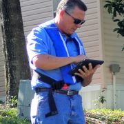
Inspector Gunther using tablet for data collection

Technology & Flood Control

As the end of Hurricane Season approaches, we can all breathe a sigh of relief. No more listening for storm alerts and watches. No more storing of canned-goods, batteries, and water. No more worrying about flooding. Wait; not so fast, localized flooding in South Florida is always a possibility. It is just a fact; mother nature tries every day to return our area to the original swamp lands of yesteryear, and every day the Lake Worth Drainage District’s canal system works to keep that from happening.

Occurring any time of the year, our tropical rainstorms can be intense and seriously threaten property and life. In response, District staff monitors canal elevations daily and coordinates the operations of water control structures. Water control structures act like dams, allowing stormwater to be released or held back depending on the conditions. The automated technology used to operate the District’s water control structures is called Supervisory Control and Data Acquisition (SCADA). As the water rises in the canal and reaches a pre-determined elevation, SCADA will slowly open control structures releasing water for flood control. Similarly, as water elevations return to normal levels the control structure gates will close, holding water back for conservation and water supply demands. In anticipation of severe weather, District staff can override the automated SCADA system and make manual adjustments.

Additionally, SCADA technology eliminates the need for District staff to venture out during dangerous weather conditions to operate control structures. If needed, staff can adjust a control structure via a mobile device from any location, thus significantly reducing response time. Another advantage to SCADA, is the capture of operational data by the system which can be used to evaluate future water supply needs and historical flood control responses. This data can be shared with regional water management partners for enhanced flood control coordination and water conservation measures.

With approximately 500 miles of canals and 20 major water control structures, the Lake Worth Drainage District is one of the largest water control districts in Florida. We are proud to provide our residents with this enhanced water management technology and dependable flood control

Man cleaning flooded home

LWDD Helps Reduce Flood Insurance

The Federal Emergency Management Agency’s (FEMA) flood map informs your community about its local flood risk. It helps establish minimum floodplain standards so that your community builds safely and resiliently. It determines the cost of flood insurance, which helps property owners to financially protect themselves against flooding. The lower your degree of risk, the lower your flood insurance premium will be.

A community typically will be re-mapped because of population growth and development, better science, and changing conditions. FEMA and state and local governments develop partnerships and identify available data, which are used to aid in the discussion and design of the flood map.

The Lake Worth Drainage District plays an important role in the production of accurate maps for our service area. Current and historic flood-related data including hydrology, infrastructure, and hydraulics, were used to determine risk identification and assessment. Because of Lake Worth Drainage District’s canal network, water control structures, and regular maintenance program, many of our communities remained in FEMA’s lower risk areas. Final flood maps are posted to the online FEMA Map Service Center, making them easily accessible to the public at http://www.fema.gov/national-flood-insurance-program/map-service-center.