Maintenance Enhanced With Drones
Approximately three years ago, the Lake Worth Drainage District (LWDD) began implementing the flying of Unmanned Aircraft Systems (UAS) commonly known as drones to monitor the canals, rights-of-way and flood control structures within its 200 square miles of service area.
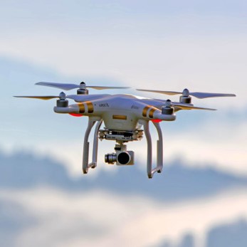
The drones are used as a professional tool to gather data, take images and video. The ‘bird’s eye-view’ provides a unique perspective that can quickly identify issues so that corrective actions can be taken before they develop into costly repairs. Due to their small size, the drones can reach areas difficult to inspect from the ground. They perform quickly and in a repetitive manner providing accurate and consistent data. Drone flights can cover large geographical areas using a two-man crew in a stationary location. This helps minimize inspection costs and avoids exposure of personnel to possible environmental risks and injuries.
LWDD deployed its drones after Hurricanes Irma & Michael. The results were very beneficial in post-storm assessments by aiding recovery teams to efficiently identify damage sites and prioritize response efforts. The data captured by the drone flights can be mapped and used for future emergency response planning by water managers.
LWDD’s operators strictly adhere to the Federal Aviation Association’s (FAA) regulations and are cognizant of surrounding homes during flights. The District’s drone operators hold a certification from the FAA, and follow strict safety practices. The use of UAS systems is one of the more recent additions to LWDD’s flood control toolbox.
The Lake Worth Drainage District is committed to implementing new technologies that will enhance flood control operations for the estimated 750,000 residents within its boundaries. For more information on the various methods used for flood control, visit https://lwddnet.wpengine.com/managing-water/overview.


