golden retriever dog in rain boots holding an umbrella

Weekend Weather Update

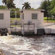
Control Structure

Technology Enhances Flood Control

South Florida’s tropical weather events can be intense and seriously threaten property and life. In response, the Lake Worth Drainage District (LWDD) monitors canal elevations and makes necessary operational adjustments to its water control structures to provide flood control for the 200 square miles of land within its boundary.

Water control structures act like dams, allowing stormwater to be released or held back depending on weather conditions. The technology used to operate LWDD’s water control structures is called Supervisory Control and Data Acquisition (SCADA). As the water rises in the canal and reaches a pre-determined elevation, SCADA will slowly open control structures releasing water for flood control. Similarly, as water elevations return to normal levels the control structure gates will close, holding back water for conservation and water supply demands.

This response to changes in the canal system happens automatically and can be monitored remotely by staff using mobile devices. However, in anticipation of severe weather, staff can override the automated SCADA system and make manual adjustments as needed. The remote monitoring and operating functions of SCADA eliminates the need for LWDD staff to venture out during dangerous weather conditions to operate control structures, as well as significantly reduces response time.

Another advantage to SCADA is the capture of operational data by the system which can be used to evaluate future water supply needs and historical flood control responses. This data can be shared with regional water management partners for enhanced flood control coordination and water conservation measures.

LWDD is proud to provide the residents and businesses within our boundary this advanced flood control technology.

Lake Okeechobee Drought 2007

Lake Okeechobee Water Management

At its meeting on April 19, 2019, the LWDD Board of Supervisors unanimously adopted Resolution 19-04 urging the U.S. Army Corps of Engineers (USACE) and the South Florida Water Management District (SFWMD) to consider the importance of protecting Palm Beach County’s water supply in the development of a new Lake Okeechobee regulation schedule.

Lake Okeechobee is part of an integrated regional water management system essential to communities, businesses, public water supply utilities and ecosystems throughout Palm Beach County. The U.S. Army Corps of Engineers (USACE) manages Lake Okeechobee water levels. The USACE is in the process of developing a new Lake Okeechobee water level regulation schedule called the Lake Okeechobee System Operating Manual (LOSOM) which will define the parameters for future management of Lake Okeechobee.

The LWDD is highly dependent on Lake Okeechobee as a source of water supply, especially during times of water shortages. As the new LOSOM is developed, LWDD urges the USACE and the South Florida Water Management District (SFWMD) to favor operational alternatives that maximize health, safety, and welfare of the water-use community. The future operational design for Lake Okeechobee should include changes that minimize the potential for short-term water supply shortages, and protect the existing permitted water allocations, which will assure the predictability of a continued and reliable source that is essential to water supply planning on local and regional levels.

The LWDD recognizes that water supply is but one of the significant public health, safety and welfare concerns that must be weighed by the USACE and SFWMD in the development of LOSOM. These include the environmental health of the Lake, the health of flora and fauna which make Lake Okeechobee home, the health of the Everglades, the health of the Caloosahatchee and St. Lucie Estuaries, and the integrity of the Herbert Hoover Dike and safety of surrounding communities.

The Lake Worth Drainage District (LWDD) provides flood control and water supply for more than 800,000 residents and more than 10,000 acres of agricultural land in Palm Beach County. The LWDD service area encompasses 218 square miles, with 13 municipalities and 511 miles of drainage canals. Additionally, LWDD water control activities provide aquifer recharge to prevent saltwater intrusion for numerous major wellfields.

A copy of the resolution can be found at LWDD Resolution 19-04.

HOme with flooding in street and front yard

How Flood Control Works

Man-made lakes and ponds are attractive enhancements to many residential communities and businesses within the Lake Worth Drainage District (LWDD). More importantly, they serve an important public safety purpose by providing stormwater storage for flood control.

When lake elevations rise due to rainfall, excess stormwater will flow through the community’s discharge control structure and into the LWDD canal. Most of this drainage occurs unnoticed by the average individual. However, during a severe storm, flooding in streets, sidewalks, and driveways may occur. This nuisance flooding may cause concern for some residents. However, these low-lying areas are designed as secondary detention areas to protect homes from flooding.

Within LWDD, flood control is a shared responsibility and achieved through an interconnected, three-tiered drainage system. By working together, these three systems provide effective flood control. This three-tiered system is made up of:

  1. tertiary, or neighborhood drainage systems operated by property owners or residential associations
  2. secondary drainage systems which are operated by LWDD
  3. the primary system operated by the South Florida Water Management District

Water managers in charge of primary and secondary systems are continually monitoring the weather and canal levels to proactively respond to changes in canal elevations. In anticipation of a heavy rainfall event, water managers will make operational adjustments to maintain appropriate water elevations for flood control. Additionally, throughout the year, routine canal maintenance is conducted to provide unobstructed flow in the canal channel and access along the canal rights-of-way.

Property owners and residential associations have similar role. They must maintain their drainage infrastructure to ensure that inlets, pipes, and discharge control structures are free of potential blockages and working as designed, thus maintaining the flow of stormwater away from their property. An annual inspection of drainage infrastructure should be made, and repairs should be completed before the start of storm season on June 1.

The likelihood of flooding depends on several variables such as rainfall volume, duration, ground moisture, and local terrain. It is important to note that flood protection does not mean flood proof. No system, no matter how well designed, is 100% flood proof. Even with quality flood control, homes and businesses may experience flooding if rainfall exceeds the drainage design or stormwater flow is blocked by debris. For more information on flood control, visit our website at www.lwdd.net/property-managers-hoa.

Photo of Drone

Maintenance Enhanced With Drones

Approximately three years ago, the Lake Worth Drainage District (LWDD) began implementing the flying of Unmanned Aircraft Systems (UAS) commonly known as drones to monitor the canals, rights-of-way and flood control structures within its 200 square miles of service area.

The drones are used as a professional tool to gather data, take images and video. The ‘bird’s eye-view’ provides a unique perspective that can quickly identify issues so that corrective actions can be taken before they develop into costly repairs. Due to their small size, the drones can reach areas difficult to inspect from the ground. They perform quickly and in a repetitive manner providing accurate and consistent data. Drone flights can cover large geographical areas using a two-man crew in a stationary location. This helps minimize inspection costs and avoids exposure of personnel to possible environmental risks and injuries.

LWDD deployed its drones after Hurricanes Irma & Michael. The results were very beneficial in post-storm assessments by aiding recovery teams to efficiently identify damage sites and prioritize response efforts. The data captured by the drone flights can be mapped and used for future emergency response planning by water managers.
LWDD’s operators strictly adhere to the Federal Aviation Association’s (FAA) regulations and are cognizant of surrounding homes during flights. The District’s drone operators hold a certification from the FAA, and follow strict safety practices. The use of UAS systems is one of the more recent additions to LWDD’s flood control toolbox.

The Lake Worth Drainage District is committed to implementing new technologies that will enhance flood control operations for the estimated 750,000 residents within its boundaries. For more information on the various methods used for flood control, visit https://lwddnet.wpengine.com/managing-water/overview.